Sea, Ice and Land: Different Perspective on the Top of the World [View all]
Today's NASA Earth Observatory view was an ephiphany for me. Somehow, in spite of the at least hundreds of hours spent looking at globes, charts and maps had never appreciated how land-locked is the Artic Ocean.
Winter sea ice cover in the Arctic was the lowest it’s ever been at its annual peak on March 22, 2025, according to NASA and the National Snow and Ice Data Center (NSIDC)...
In the dark and cold of winter, sea ice forms and spreads across Arctic seas. But in recent years, less new ice has been forming, and less multi-year ice has accumulated.
This winter continued a downward trend scientists have observed over the past several decades.
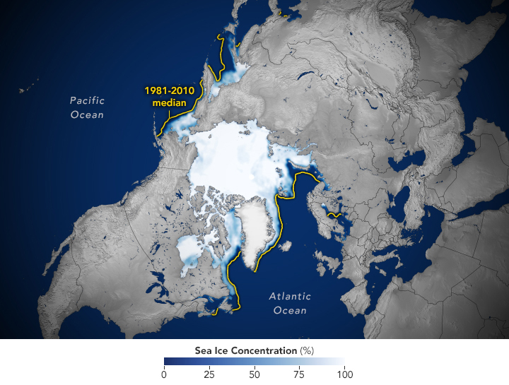
The map above shows the ice extent on March 22, the day of the 2025 maximum. To determine extent, scientists project satellite observations of sea ice onto a grid and then add up the total area of each cell that is at least 15 percent ice-covered. The yellow outline shows the median sea ice extent for March (1981-2010), the month when the ice generally reaches its maximum extent...
https://earthobservatory.nasa.gov/images/154122/winter-sea-ice-reached-new-lows-in-the-arctic
I think it's the presence of the ice (absent on most depictions) which made this so striking this morning. Seeing it this way makes me wonder why it is not named the "Artic Sea", as it does seem so closely encompassed by land. After all Mediterranean—
medius (middle)+
terra(earth)—Sea means something like "the sea in the middle of the earth" (Wikipedia)
What is the difference between a "sea" and an "ocean" as, in a sense, all bodies of water are surrounded by land on our little planet. Likely a matter of areal extent? NOT an internet rabbit hole will be going down today!
 = new reply since forum marked as read